|
Trails
1. Artimis Trail
Starting point: 300 m from the junction between the Chionistra rood and
the Troodos Prodromos road at an altitude of 1850m
Length: 7 kms Time: 21/2 hours
Points of Interest: The Pinus Nigra forest, rare species of flora and
rocks of the area. Of historic interest are the ruins of rough fortifications
built during the final yea- of the Venetian occupation of Cyprus (1571
AD) by a group of Venetian generals who decided to put up a defence against
the Ottomans at that point. It ends at a point on the Atalanti trail.
2.
Atalanti Trail (Circular)
Starting Point: Troodos Square
Length: 12 kms Time: 5 hours
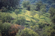
Points of Interest: The trail goes around Chionistra at an altitude of
1700-1750 m., passing through dense thickets of Pinus Nigra and Troodos
Juniper Phoenicia. One of the largest Junipers, which are 800 years old,
can be found in the area. There is an outstanding view of the entire island.
Of particular interest is the entrance to a disused chromium mine, which
ceased its operations in 1982. At 3 kms from the Troodos Square is a spring
with drinking water.
3.
Persephone Trail
Starting point: 150 m South of Troodos Square. Walkers must either return
to the starting point or be picked up at the point where the trail crosses
the forest road.
Length: 3 kms
Time: 1 hour to return to starting point
Points of Interest: Rich vegetation and a breathtaking view from Makria
Kontarka.
4.
Kampos tou Livadiou (Circular)
Starting point: The forest rood leading to the "Kampos tou Livadiou"
picnic site 3 kms from Troodos square and 9 kms from Karvounas.
Length: 3 kms
Time: 11/2 hours
Points of Interest: A significant number of centuries-old Pinus Nigra.
The trail is linked to "Kampos tou Livadiou" picnic site.
5.
Kalidonia
Starting point: About 700m from the road between Troodos and Platres near
the president's summer residence. Also accessible via a forest rood which
begins at the tourist road 2 kms from the Square.
Length: 3 kms Time: 11/2 hours
Points of Interest: The trail follows a course along Kryos Potamos river,
which never runs dry. It passes the Kalidonia Falls and ends at Psilo
Dendro, in Pano Platres.
|


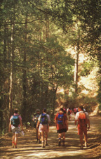
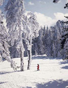
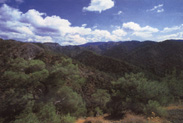 Troodos
National Forest Park is at the centre of the island and covers an area
of 9337 hectares. The highest point is Chionistra or Olympos (1952 m)
and the lowest is Moni forest (700m). The area is magical and suitable
for a variety of activities such as hiking, skiing, mountain cycling,
nature study and picnics. Over 770 plant species have managed to survive,
making Troodos NFP the richest botanical garden of Cyprus. The area's
geology is of world-wide importance. The world's best-preserved philological
complex is studied by scientists with a view to achieving an understanding
of haw the ocean's crust was created 90 million years ago at the bottom
of a vast ocean known to geologists as the "sea of Tethys". Along the
trails, one can see samples of plutonic rock, which were created by the
crystallization of magma, which took place 2000-6000 m, under the bottom
of the ocean. In the area 10 trails exist covering a total lenght of 50
kms.
Troodos
National Forest Park is at the centre of the island and covers an area
of 9337 hectares. The highest point is Chionistra or Olympos (1952 m)
and the lowest is Moni forest (700m). The area is magical and suitable
for a variety of activities such as hiking, skiing, mountain cycling,
nature study and picnics. Over 770 plant species have managed to survive,
making Troodos NFP the richest botanical garden of Cyprus. The area's
geology is of world-wide importance. The world's best-preserved philological
complex is studied by scientists with a view to achieving an understanding
of haw the ocean's crust was created 90 million years ago at the bottom
of a vast ocean known to geologists as the "sea of Tethys". Along the
trails, one can see samples of plutonic rock, which were created by the
crystallization of magma, which took place 2000-6000 m, under the bottom
of the ocean. In the area 10 trails exist covering a total lenght of 50
kms.